Rongai Route Kilimanjaro
The Rongai Route is the only route that climbs Kilimanjaro from the north, starting at Rongai (Nalemoru) Gate near the Kenyan border and descending on the southern side via the Marangu Route. It usually takes six to seven days, has gentle gradients and low traffic, and the drier northern slopes make it a good choice in the rainy months. On seven days, with a night at Mawenzi Tarn, it offers good acclimatisation for first-time climbers.
The Rongai Route offers a quieter, gentler way to climb Mount Kilimanjaro, approaching from the remote northern slopes rather than the much busier southern and western sides of the mountain. It suits climbers who want peaceful camps, steady walking and a good chance of dry weather, while still reaching the same summit at Uhuru Peak. This guide explains the Rongai Route at a glance, walks you through a seven-day itinerary day by day, compares its pros and cons, shows the best time to climb, compares it with other routes and answers common questions about planning your private, tailor-made Rongai climb.
Rongai Route at a Glance
Before choosing the Rongai Route, it helps to see its key facts in one place, from where it starts and finishes to how hard it is and who it really suits best. Rongai is unusual because you start on the northern side of Kilimanjaro and finish on the southern side, so you see both faces of the mountain on one climb. The table below summarises the Rongai Route at a glance. Altitudes and days are approximate and based on our usual seven-day itinerary, which we can adjust to your fitness, dates and acclimatisation needs on a private climb.
| Feature | Rongai Route |
|---|---|
| Start | Rongai (Nalemoru) Gate, about 1,990 m |
| Finish | Marangu Gate, south-east side |
| Usual length | 6–7 days on the mountain |
| Summit | Uhuru Peak, 5,895 m, via Gilman's Point |
| Difficulty | Moderate, with gentle gradients |
| Acclimatisation | Good on seven days |
| Accommodation | Camping; descent via Horombo Hut |
| Traffic | Low, one of the quietest routes |
Rongai Route Map
The Rongai Route crosses Kilimanjaro from north to south, so it really helps to picture the whole journey clearly before you start walking. You begin at Rongai Gate on the northern slopes, climb past Simba Camp, Second Cave, Kikelelwa and Mawenzi Tarn, cross the high Saddle to Kibo Hut and reach Uhuru Peak via Gilman's Point. You then descend on the southern side to Horombo Hut and Marangu Gate. The simple route map below shows each stop in order with its approximate altitude, so you can follow how the climb gains height gradually and steadily before summit night.
- Rongai Gate1,990 mStart
- Simba Camp2,570 mNight 1
- Second Cave3,450 mNight 2
- Kikelelwa3,630 mNight 3
- Mawenzi Tarn4,330 mNight 4
- Kibo Hut4,700 mNight 5
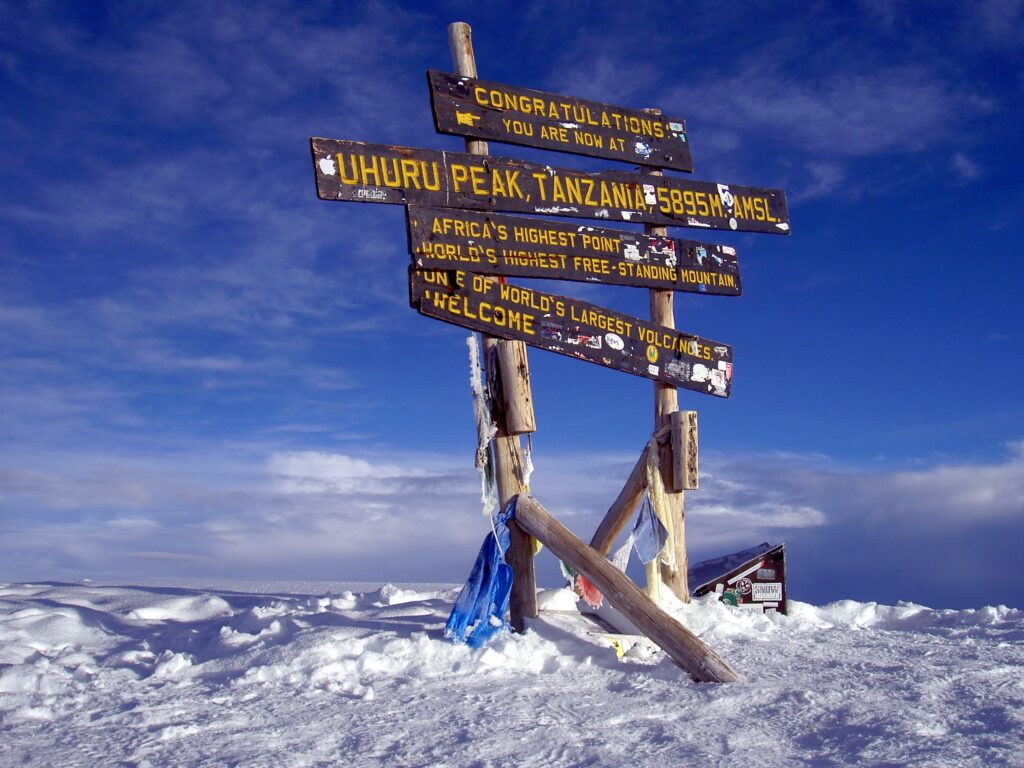
- Uhuru Peak5,895 mSummit
- Horombo Hut3,720 mNight 6
- Marangu Gate1,860 mFinish
Schematic route map, not to scale, with approximate altitudes. You climb on the northern side and descend on the southern Marangu Route.
Rongai Route Distance
The Rongai Route covers a total distance of roughly 73 kilometres, or about 45 miles, from Rongai Gate to Uhuru Peak and down to Marangu Gate, although published figures vary slightly with the exact path taken. Most walking days are moderate in length and pace, with one very long day on summit night, when you climb to the top and descend to Horombo Hut. The table below shows how the distance is roughly split across the climb. Distances are approximate, and on the mountain the time you walk matters more than kilometres, because altitude slows everyone down considerably.
| Section | Length | What to expect |
|---|---|---|
| Rongai Gate to Kibo Hut | 5 days of ascent | Gradual climb through forest, moorland and alpine desert |
| Kibo Hut to Uhuru Peak | Summit night | Steep scree to Gilman's Point, then the crater rim |
| Uhuru Peak to Horombo Hut | Same day | Long descent via Kibo Hut |
| Horombo Hut to Marangu Gate | Final day | Moorland and rainforest on the Marangu Route |
| Total | About 73 km (45 miles) | 6–7 days on the mountain |
How Many Days on the Rongai Route?
The Rongai Route can be climbed in six or seven days, and the number of days you choose on the mountain makes a real difference to your comfort and acclimatisation. The seven-day itinerary adds a valuable night at Mawenzi Tarn, giving your body more time to adjust before you cross the Saddle to Kibo Hut. The table below compares the six-day and seven-day Rongai itineraries side by side. We recommend seven days for most climbers, especially first-timers, because the extra day costs relatively little but makes the summit night safer, easier and much more enjoyable on the mountain.
| Feature | 6-day Rongai | 7-day Rongai |
|---|---|---|
| Days on the mountain | 6 days | 7 days |
| Night at Mawenzi Tarn | Short or none | Yes, extra acclimatisation |
| Acclimatisation | Fair | Good |
| Daily walking | Longer days | More relaxed pace |
| Best for | Climbers with recent altitude experience | Most climbers and first-timers |
| Park fees (indicative) | About US$814 | About US$956 |
7-Day Rongai Route Itinerary
A seven-day Rongai climb gains altitude gradually through the northern rainforest, moorland and alpine desert, with a valuable acclimatisation night at Mawenzi Tarn before crossing the Saddle to Kibo Hut. Summit night follows the Marangu summit path via Gilman's Point, and you then descend on the southern side. The seven tabs below describe each day of our usual private itinerary in detail, with the camps, approximate altitudes, changing landscape and main highlights of each day. Walking times vary with pace and weather, and your guide will always adjust the plan to how you are feeling on the mountain.
Rongai Gate to Simba Camp
Rongai Gate to Simba Camp
about 1,990 m to 2,570 m
After a scenic drive to the northern side of Kilimanjaro and registration at Rongai Gate, you begin walking through quiet montane forest and farmland edges. The trail climbs gently, giving an easy introduction to the mountain. Look out for colobus monkeys and forest birds before reaching Simba Camp, where your crew has set up camp for your first night.
View the 7-Day Rongai Climb →Simba Camp to Second Cave
Simba Camp to Second Cave
about 2,570 m to 3,450 m
The forest gives way to open heath and moorland as you climb steadily towards Second Cave. Giant heathers and volcanic rocks line the trail, and on clear days you see the jagged peak of Mawenzi ahead and the plains of Kenya behind. The gradual gain helps your body adjust, and the camp sits in a peaceful moorland setting.
View the 7-Day Rongai Climb →Second Cave to Kikelelwa Camp
Second Cave to Kikelelwa Camp
about 3,450 m to 3,630 m
A shorter, easier day takes you across the open moorland towards Kikelelwa Camp, set in a sheltered valley near Kikelelwa Caves. The modest altitude gain is quite deliberate, giving your body time to acclimatise before higher camps. Afternoons are relaxed, with time to rest, enjoy the quiet northern wilderness and walk a little higher with your guide.
View the 7-Day Rongai Climb →Kikelelwa to Mawenzi Tarn
Kikelelwa Camp to Mawenzi Tarn
about 3,630 m to 4,330 m
Today you climb fairly steeply into the stark alpine desert to Mawenzi Tarn, one of the most beautiful camps on Kilimanjaro. The camp sits beside a small mountain lake beneath the dramatic spires of Mawenzi peak. Many climbers take a short acclimatisation walk above camp in the afternoon, following the climb-high, sleep-low principle before dinner.
View the 7-Day Rongai Climb →Mawenzi Tarn to Kibo Hut
Mawenzi Tarn to Kibo Hut
about 4,330 m to 4,700 m
You cross the Saddle, a vast, high and almost lunar desert between Mawenzi and Kibo, to reach Kibo Hut at the base of the summit cone. The walking is gentle but the altitude makes it tiring, so take it slowly and keep drinking. After an early dinner and summit briefing, you rest for a few hours before the final ascent.
View the 7-Day Rongai Climb →Summit to Horombo Hut
Kibo Hut to Uhuru Peak, then Horombo Hut
about 4,700 m to 5,895 m, down to 3,720 m
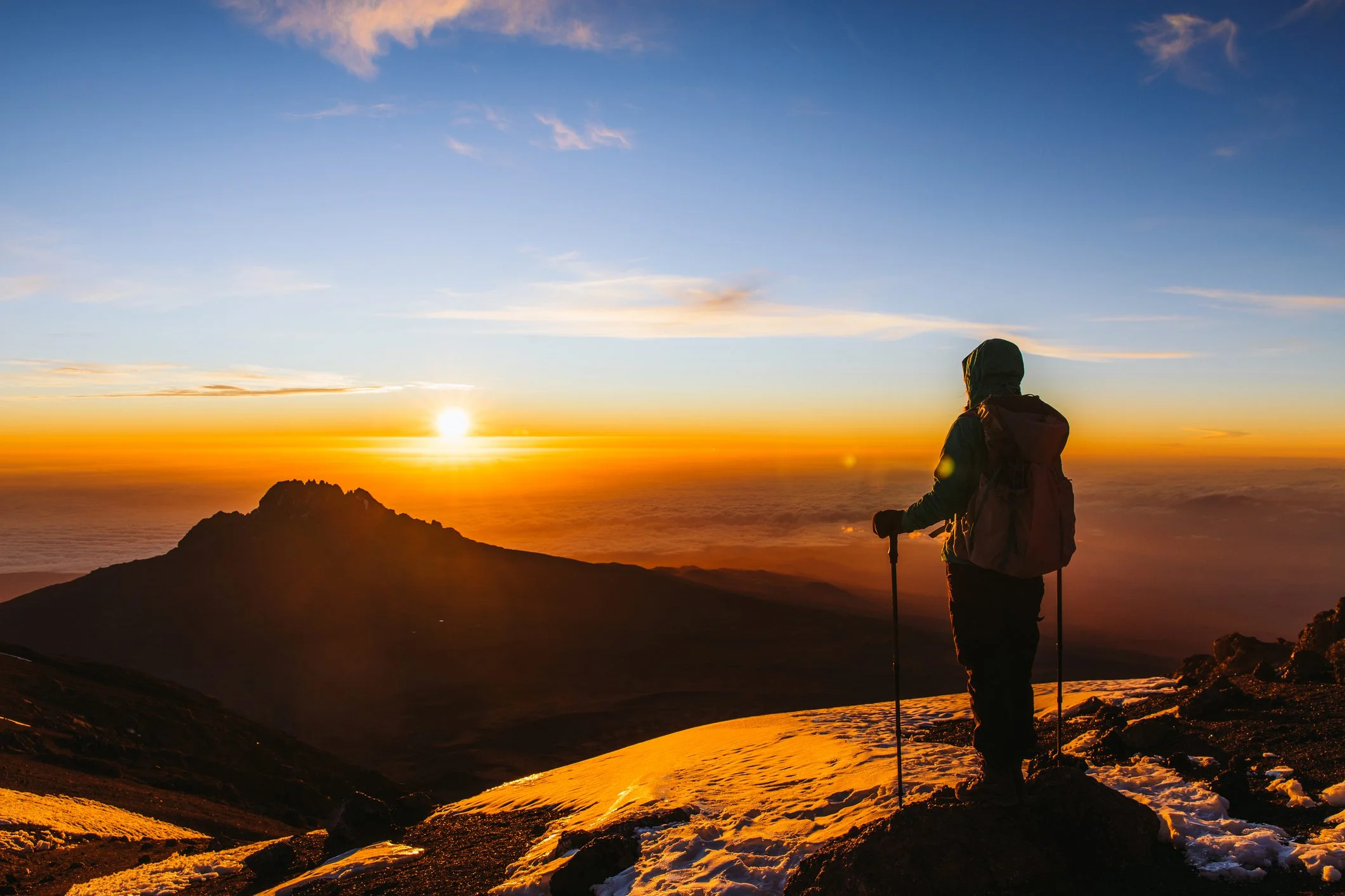
You start around midnight and climb steep scree by headlamp to Gilman's Point on the crater rim, usually near sunrise. A further walk around the rim leads to Uhuru Peak at 5,895 metres, the roof of Africa. After summit photos you return to Kibo Hut for a short rest, then continue down to Horombo Hut for the night.
View the 7-Day Rongai Climb →Horombo to Marangu Gate
Horombo Hut to Marangu Gate
about 3,720 m to 1,860 m
The final day descends steadily through moorland and lush rainforest on the Marangu Route to Marangu Gate. With thicker air, most climbers feel strong, proud and happy. At the gate you sign out, receive your summit certificate and say farewell to your crew before driving back to your hotel in Moshi or Arusha to celebrate.
View the 7-Day Rongai Climb →Scenery on the Rongai Route
The Rongai Route passes through all of Kilimanjaro's climate zones, from quiet northern forest to the icy summit, and its scenery feels wilder and more remote than the busier southern routes. Because you climb on the northern side and descend on the southern side, you see both faces of the mountain on one climb. The six cards below describe the main landscapes and highlights you will see on the Rongai Route. Clear mornings often bring the best views, so keep your camera close at hand at camp and on the early part of each day's walk on the mountain.
Quiet montane forest with colobus monkeys and birdlife.
Giant heathers, volcanic rocks and open skies.
Wide views north over the plains towards Amboseli.
A small lake beneath the jagged spires of Mawenzi.
A vast, lunar desert between Mawenzi and Kibo.
Sunrise over the crater rim and summit ice fields.
How to Get to the Rongai Route
Rongai Gate lies on the remote northern side of Kilimanjaro, close to the Kenyan border, so reaching it takes a little longer than reaching the busier southern gates. Most climbers fly into Kilimanjaro International Airport, spend a night in Moshi or Arusha for a briefing and gear check, and then drive to the gate on the first morning of the climb. The table below shows the usual transfer times to Rongai Gate. Your private vehicle and driver collect you from your hotel, and the long, scenic drive passes through villages and farmland on the mountain's eastern and northern slopes.
| From | Transfer | Approximate time |
|---|---|---|
| Kilimanjaro International Airport | Airport to Moshi or Arusha | About 1 hour to Moshi |
| Moshi | Hotel to Rongai Gate | About 3–4 hours |
| Arusha | Hotel to Rongai Gate | About 4–5 hours |
| Marangu Gate (finish) | Gate to Moshi | About 1 hour |
Rongai Route Summit Success
Many websites confidently quote summit success rates for each Kilimanjaro route, but Kilimanjaro National Park does not publish up-to-date official figures by route, so most numbers you see online are only estimates from individual operators. What is very clear is that longer itineraries give your body much more time to acclimatise, and that is the biggest factor in reaching Uhuru Peak. The six cards below show what really improves your chances of summiting on the Rongai Route. Choosing seven days, walking slowly, drinking well and following your guide's advice all make a real and measurable difference on summit night.
The extra night at Mawenzi Tarn helps your body adapt.
A slow, steady pace saves energy for summit night.
Good hydration supports your body at altitude.
Carbohydrate-rich meals keep your energy up.
Tell your guide about headaches or nausea straight away.
Regular hiking builds stamina and confidence.
How Much Does the Rongai Route Cost?
The cost of a Rongai Route climb depends mainly on the number of days, the overall comfort level you choose and how many climbers share your private crew and camp. Kilimanjaro National Park fees are a large part of every price, and a longer itinerary adds more park fees but also improves acclimatisation. The table below shows our general Kilimanjaro price ranges by comfort level, which apply to the Rongai Route. We confirm an exact written quote for your private Rongai climb, listing park fees, guides, crew, meals, equipment and transfers, so there are no hidden extras or surprises.
| Comfort level | Price per person | What you get |
|---|---|---|
| Budget | US$1,800–2,500 | Standard tents and mats, fresh meals, licensed guides |
| Mid-range | US$2,500–3,500 | Better tents and mats, more varied meals, extra comforts |
| Luxury | US$4,000+ | Walk-in tents, private toilet, gourmet-style meals |
Rongai Route Pros and Cons
Every Kilimanjaro route has its own strengths and trade-offs, and the quiet Rongai Route on the northern side is certainly no exception. It is quieter and drier than most routes, with gentle gradients, but it has fewer climb-high, sleep-low days and less varied scenery than the Lemosho or Machame routes. The two lists below summarise the main advantages and disadvantages of the Rongai Route, so you can decide whether it really suits your own priorities. Choosing the seven-day itinerary, with an extra night at Mawenzi Tarn, reduces the main drawback and makes Rongai a strong choice for first-time climbers.
Advantages
- Quiet trail with low traffic
- Drier northern slopes, good in rainy months
- Gentle, steady gradients
- Views of both sides of the mountain
- Beautiful Mawenzi Tarn camp
Disadvantages
- Longer drive to the northern gate
- Fewer climb-high, sleep-low days
- Less scenic variety than Lemosho or Machame
- Steep scree on summit night
- Shares the busier Marangu descent
Best Time to Climb the Rongai Route
You can climb the Rongai Route all year, but the weather on Kilimanjaro generally follows two dry seasons and two rainy seasons. Because the northern slopes receive less rain than the southern side, Rongai is one of the best routes to choose in the wetter months, when other routes can be muddy and cloudy. The table below shows what to expect in each season on the Rongai Route. Whatever the month, nights at high camps are cold, so pack plenty of warm layers, and book early for the busy dry-season months to secure your preferred private climb dates.
| Months | Weather | Rongai Route |
|---|---|---|
| January to early March | Dry and generally clear | Excellent; quieter than mid-year |
| Late March to May | Long rains | Good alternative; northern side drier |
| June to October | Dry, cool and clear | Excellent; most popular months |
| November to mid-December | Short rains | Good; showers usually brief |
Rongai vs Other Kilimanjaro Routes
If you are still deciding between Rongai and another route, it really helps to compare them carefully side by side before you finally book. Rongai is often compared with Marangu, which shares its descent, and with the Machame and Lemosho routes on the southern and western sides. The table below compares the Rongai Route with these popular alternatives on length, traffic, acclimatisation and main scenery highlights. Indicative park fees for a seven-day Rongai climb are about US$956 per person including VAT, and we confirm the latest fees and a complete price in every private climb quote we send.
| Route | Days | Traffic | Acclimatisation | Scenery |
|---|---|---|---|---|
| Rongai | 6–7 days | Low | Good | Quiet north, Mawenzi Tarn |
| Marangu | 5–6 days | Moderate to high | Fair | Huts, gentle path |
| Machame | 6–7 days | High | Good | Barranco Wall, varied |
| Lemosho | 7–8 days | Moderate | Very good | Shira Plateau, varied |
Rongai Route: FAQs
Where does the Rongai Route start?
The Rongai Route starts at Rongai Gate, also called Nalemoru Gate, on the northern side of Kilimanjaro close to the Kenyan border, at about 1,990 metres. The drive from Moshi takes about three to four hours.
How many days is the Rongai Route?
The Rongai Route usually takes six or seven days on the mountain. We recommend seven days, which includes a night at Mawenzi Tarn and gives better acclimatisation before summit night.
Is the Rongai Route easy?
No Kilimanjaro route is easy, but Rongai has some of the gentlest gradients on the mountain. The main challenge is altitude and the steep scree on summit night, so a seven-day itinerary and a slow pace are important.
Is the Rongai Route good for beginners?
Yes. Its gentle gradients, quiet camps and drier weather make Rongai a good choice for first-time climbers, especially on the seven-day itinerary. Lemosho on eight days offers even better acclimatisation.
Is the Rongai Route crowded?
No. Rongai is one of the quietest routes on Kilimanjaro because the northern gate is further from Moshi. It becomes busier on the descent, which follows the Marangu Route.
What is the best time to climb the Rongai Route?
The best months are January to early March and June to October. Because the northern side is drier, Rongai is also one of the best routes during the rainy months of April, May and November.
Where do you descend on the Rongai Route?
You descend on the southern side via the Marangu Route, spending the last night at Horombo Hut and finishing at Marangu Gate. This lets you see both the northern and southern sides of the mountain.
How does Rongai compare with Lemosho?
Rongai is quieter, drier and more gentle, while Lemosho offers better acclimatisation and more varied scenery across the Shira Plateau and southern circuit. Both are good choices for first-time climbers.
Do you sleep in tents on the Rongai Route?
Yes. Rongai is a camping route, with tents set up by your crew at each campsite. On the descent, the final night is at Horombo Hut on the Marangu Route, where you may sleep in a hut or tent.
Can I see wildlife on the Rongai Route?
Wildlife is limited at high altitude, but in the northern forest you may see colobus monkeys, blue monkeys and many birds. Larger animals are rarely seen on the trail itself.
How long is the Rongai Route in kilometres?
The Rongai Route is roughly 73 kilometres, or about 45 miles, in total, including the descent on the Marangu Route to Marangu Gate. Figures vary slightly between sources depending on the exact path used.
What is the summit success rate on the Rongai Route?
Kilimanjaro National Park does not publish up-to-date official success rates by route, so figures online are operator estimates. Your chances are best on the seven-day itinerary, with a slow pace, good hydration and careful acclimatisation.
How much does the Rongai Route cost?
Our Kilimanjaro climbs range from about US$1,800–2,500 per person for budget, US$2,500–3,500 for mid-range and US$4,000 or more for luxury, depending on days, comfort and the number of climbers in your private party. Park fees for seven days are about US$956 per person.
How do I get to the Rongai Route?
Fly into Kilimanjaro International Airport and stay a night in Moshi or Arusha. On the first morning, your private vehicle drives you to Rongai Gate on the northern side of the mountain, about three to four hours from Moshi.
More Kilimanjaro Guides
Climb Kilimanjaro via the Rongai Route
Tell us your dates, fitness and comfort wishes, and our Arusha mountain team will plan your private Rongai climb with a clear, day-by-day quote.
Start Planning