Kilimanjaro Geology: Formation, Cones, Rocks and Glaciers
Kilimanjaro Geology
The geology of Mount Kilimanjaro is one of the most fascinating volcanic stories in Africa and the world. As the highest free-standing mountain on Earth, Kilimanjaro is a dormant stratovolcano formed through intense volcanic activity linked to the East African Rift System. Its structure reveals millions of years of geological evolution, including lava eruptions, ash deposits, and successive volcanic cone formations. The mountain consists of three main volcanic peaks—Kibo, Mawenzi, and Shira—each representing different geological stages. Understanding Kilimanjaro’s geology helps explain its dramatic landscapes, glacial features, and unique soil composition. It is a key subject in African volcanology, tectonic plate movement, and mountain formation studies. Today, Kilimanjaro remains a major attraction for climbers, geologists, and researchers studying volcanic mountains, extinct volcano systems, and the geological history of East Africa.
- 1~2.5 million years ago: Shira begins erupting.
- 2~1 million years ago: Mawenzi builds up.
- 3Within the last ~500,000 years: Kibo grows into the highest cone.
- 4~360,000 years ago: Kibo’s last major eruption.
- 5~150,000–200,000 years ago: last minor activity.
- 6Today: dormant, with fumaroles in the Ash Pit.
Formation of Mount Kilimanjaro
Mount Kilimanjaro was formed through volcanic activity associated with the East African Rift Valley. Millions of years ago, tectonic plate movement created deep fractures in the Earth’s crust, allowing magma to rise to the surface. This repeated eruption process built up layers of lava and ash, gradually forming a massive stratovolcano. Kilimanjaro’s formation began with Shira volcano, followed by Mawenzi, and finally Kibo, which is the youngest and highest cone. The mountain’s geological structure reflects multiple phases of volcanic growth and collapse. Kilimanjaro geology is a classic example of hotspot and rift-related volcanism in Africa. Today, scientists study its formation to understand plate tectonics, volcanic mountain building, and the evolution of large dormant volcanoes. Its layered structure is evidence of repeated eruptions over hundreds of thousands of years.
- 1Tectonic movement opens fractures in the crust.
- 2Magma rises and erupts repeatedly.
- 3Layers of lava and ash build a stratovolcano.
- 4Shira forms first, then Mawenzi, then Kibo.
- 5Collapse, erosion and glaciers shape today’s mountain.
The East African Rift System Influence
The East African Rift System plays a critical role in the geology of Mount Kilimanjaro. This massive tectonic boundary is where the African Plate is slowly splitting into two separate plates, creating volcanic activity across East Africa. Kilimanjaro formed due to magma rising through fractures created by this rifting process. The continuous movement of the Earth’s crust allows heat and pressure to escape, leading to volcanic eruptions that built the mountain. Kilimanjaro geology is therefore closely linked to continental rifting, fault lines, and mantle upwelling. This geological setting also explains the presence of other volcanic mountains in Tanzania and Kenya. Scientists use Kilimanjaro as a key example of rift-related stratovolcano formation and tectonic evolution in Africa.
- Plates separateAfrican Plate splitting
- Crust thinsFaults & fractures
- Mantle upwellingMagma rises
- Volcanoes formKilimanjaro, Meru & more
The Three Volcanic Cones: Kibo, Mawenzi, and Shira
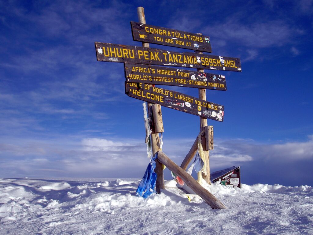
Kilimanjaro consists of three major volcanic cones: Kibo, Mawenzi, and Shira, each representing different geological stages. Shira is the oldest and largely eroded cone, now forming a plateau. Mawenzi is rugged and heavily eroded, showing sharp peaks and volcanic remnants. Kibo is the youngest and highest cone, still preserving its volcanic structure, including the famous Uhuru Peak. Kilimanjaro geology is best understood through these three cones, which illustrate successive volcanic eruptions and collapses. Each cone was formed by different eruption cycles, lava flows, and volcanic ash deposits. Kibo’s summit caldera, with the inner Reusch Crater, is evidence of past volcanic activity. Together, these cones provide a geological timeline of Kilimanjaro’s volcanic evolution and stratovolcano development.
Stratovolcano Structure of Kilimanjaro
Mount Kilimanjaro is classified as a stratovolcano, meaning it is built from multiple layers of hardened lava, volcanic ash, and tephra. This layered structure results from repeated eruptions over time, creating a steep, conical mountain shape. Kilimanjaro geology shows alternating deposits of basaltic lava flows and pyroclastic materials. Many stratovolcanoes are known for explosive eruptions and complex internal structures. Kilimanjaro’s stratovolcanic nature explains its massive height and varied terrain, from lowland forests to icy summit zones. Unlike gently sloping shield volcanoes, stratovolcanoes are steeper and more layered, although many of Kilimanjaro’s eruptions were effusive lava flows rather than violent explosions. The mountain’s internal structure is still studied by geologists to understand volcanic activity, magma movement, and eruption history in East Africa.
- Steep, conical shape
- Alternating lava & ash layers
- Builds very tall peaks
- Broad, gentle slopes
- Mostly runny basalt lava
- Usually lower and wider
Lava Flows and Volcanic Activity
Lava flows are a key component of Kilimanjaro's geology, shaping its slopes and valleys. Over millions of years, molten lava erupted from volcanic vents and cooled into solid rock, forming layers that built the mountain. These lava flows vary in composition, including basaltic and trachytic materials. Each eruption added new geological layers, contributing to Kilimanjaro’s massive size. The volcanic activity that formed Kilimanjaro is now dormant, with no recent major eruptions. However, signs of past activity remain visible in lava tubes, craters, and hardened flow patterns. Scientists study these lava formations to understand eruption cycles and volcanic hazards in stratovolcano systems. Kilimanjaro’s lava history is essential in reconstructing its geological timeline.
- Basalt
- Trachyte
- Phonolite
- Pumice
- Lava tubes
- Hardened flow patterns
Ash Deposits and Pyroclastic Layers
Ash deposits and pyroclastic materials are important elements of Kilimanjaro geology. During volcanic eruptions, explosive activity released ash clouds, pumice, and fragmented rock that settled across the mountain. These deposits formed distinct layers between lava flows, contributing to the stratified structure of Kilimanjaro. Pyroclastic layers are especially visible in exposed cliffs and eroded sections of the mountain. These materials help geologists identify different eruption phases and volcanic intensity. Kilimanjaro’s ash layers also influence soil fertility, supporting rich vegetation on its lower slopes. The study of these deposits provides insight into past explosive eruptions and volcanic behavior in East Africa’s rift volcanoes.
- Ash
- Pumice
- Tephra
- Pyroclastic fragments
- Fertile soils
Kibo Crater and Reusch Crater Formation
The summit of Kibo contains the famous Reusch Crater, a key feature in Kilimanjaro geology. This crater was formed by volcanic collapse and past eruptive activity at the summit of the youngest cone. Inside the crater, geologists find fumaroles—small vents releasing volcanic gases—indicating residual geothermal activity. The crater’s structure includes layered rock walls, lava formations, and ice remnants. Kilimanjaro’s summit area provides important evidence of volcanic evolution and summit collapse processes. Although the volcano is considered dormant, the crater shows that geological heat still exists beneath the surface. The Kibo crater is a major focus of volcanic research in Africa.
Mawenzi Geological Features
Mawenzi is the second-highest peak of Kilimanjaro and represents an ancient volcanic cone. Kilimanjaro geology shows that Mawenzi is heavily eroded, with sharp ridges, volcanic plugs, and exposed rock formations. Unlike Kibo, Mawenzi is extinct and has no volcanic activity. Its rugged landscape is the result of millions of years of erosion and weathering. Geologists study Mawenzi to understand how volcanic cones degrade over time. The peak provides insights into volcanic rock composition, structural collapse, and erosion processes. Mawenzi’s dramatic terrain is a natural laboratory for studying extinct volcanic systems in East Africa.
Shira Plateau Geological History
Shira is the oldest volcanic cone of Kilimanjaro and now forms a broad plateau. Kilimanjaro geology indicates that Shira collapsed after volcanic activity ceased millions of years ago. Today, it is characterized by rolling plains, eroded lava formations, and sediment deposits. The plateau was once a massive volcanic peak but has been shaped by erosion and geological instability. Shira provides evidence of early volcanic activity in Kilimanjaro’s formation. It also plays a role in understanding caldera collapse and long-term volcanic evolution. The Shira Plateau is now crossed by Kilimanjaro’s western trekking routes, including Lemosho, Shira and Machame, and remains important for geological studies.
Glacial Features and Ice Cap Geology
Despite being near the equator, Kilimanjaro features glaciers and ice caps at its summit. Kilimanjaro geology includes evidence of past and present glacial erosion, which has shaped the mountain’s upper slopes. Ice movement has carved valleys, ridges, and polished rock surfaces. However, these glaciers are rapidly shrinking due to climate change. Scientists study Kilimanjaro’s ice formations to understand paleoclimate history and environmental change. The presence of glaciers on a tropical volcano makes Kilimanjaro a unique geological and climatic landmark. These ice features also interact with volcanic rock, influencing erosion patterns.
Soil Formation and Mineral Composition
Kilimanjaro’s geology directly influences its rich and diverse soil composition. Volcanic rock weathers over time to form fertile soils rich in minerals such as iron, magnesium, and potassium. These soils support lush vegetation on the mountain’s lower slopes. Kilimanjaro geology explains why agricultural activities thrive in the surrounding regions. Different volcanic layers contribute to variations in soil texture and fertility. Lava breakdown and ash deposits play a major role in soil development. Scientists study these soils to understand nutrient cycles and volcanic soil ecosystems in tropical mountain environments.
- Iron
- Magnesium
- Potassium
- Coffee farms
- Banana groves
- Rich lower-slope forests
Geological Significance in East Africa
Mount Kilimanjaro is one of the most important geological landmarks in East Africa. Its formation provides key insights into volcanic activity, tectonic movement, and mountain-building processes within the East African Rift System. Kilimanjaro geology helps scientists understand how stratovolcanoes evolve and eventually become dormant. It also serves as a reference point for studying other volcanic mountains in the region. The mountain is a natural laboratory for geology, volcanology, and climate research. Its unique structure makes it a globally significant site for earth science studies and geological tourism.
- Shira is the oldest of Kilimanjaro’s three cones.
- Kilimanjaro is a shield volcano.
- Mawenzi still has active fumaroles.
- Kilimanjaro has glaciers because of its altitude, not its volcano.
Kilimanjaro Geology Basics: Questions Answered
The geology of Mount Kilimanjaro is defined by a massive volcanic system located within the East African Rift Zone. It is composed mainly of volcanic rocks formed through repeated eruptions over hundreds of thousands of years. Kilimanjaro’s structure includes layers of lava flows, ash deposits, and solidified magma that built its immense volcanic cones. The mountain is primarily made of basalt, trachyte, and phonolite rocks, typical of stratovolcano formations. Its geology reflects intense tectonic activity, where the Earth’s crust is pulling apart. This creates magma movement, shaping Kilimanjaro into Africa’s highest volcanic mountain with a complex and layered geological history.
Mount Kilimanjaro was formed through volcanic activity driven by the East African Rift system, where tectonic plates are slowly separating. This movement allowed magma to rise from deep within the Earth’s mantle, creating successive volcanic eruptions over time. The mountain developed in three main stages, forming Shira, Mawenzi, and Kibo cones. Each cone represents different phases of volcanic activity, with Kibo being the youngest and highest. Lava flows built the massive volcanic base, while eruptions added layers over time. This long geological process created a classic stratovolcano structure, making Kilimanjaro one of the most iconic volcanic mountains in the world.
Mount Kilimanjaro is a stratovolcano, also known as a composite volcano. This type of volcano is built from multiple layers of hardened lava, volcanic ash, and tephra. Stratovolcanoes are known for their steep slopes and large, conical shape. Kilimanjaro’s structure was formed through repeated explosive and effusive eruptions over time. Its three volcanic cones—Kibo, Mawenzi, and Shira—are classic features of a complex stratovolcanic system. The mountain’s geology shows alternating layers of solidified lava flows and pyroclastic materials. This structure contributes to its dramatic landscape and makes it one of the most studied stratovolcanoes in Africa.
Kilimanjaro has three volcanic cones: Kibo, Mawenzi, and Shira. Kibo is the highest and youngest cone, containing the famous Uhuru Peak, the highest point in Africa. Mawenzi is older, heavily eroded, and rugged, with sharp volcanic peaks formed by past eruptions. Shira is the oldest cone, now mostly collapsed, forming a plateau. These cones represent different stages of volcanic development in Kilimanjaro’s geological history. Together, they show how volcanic activity shifted over time across the mountain. Kibo remains dormant but geothermally active, while Mawenzi and Shira are extinct, showcasing the evolution of a massive stratovolcano system.
Kilimanjaro’s geology is important because it reveals the history of volcanic activity in East Africa and the dynamics of the East African Rift System. It provides valuable scientific insight into how stratovolcanoes form and evolve. The mountain’s layered volcanic rocks help geologists study past eruptions, climate changes, and tectonic movement. Its geological structure also influences ecosystems, water sources, and soil fertility in surrounding regions. Additionally, Kilimanjaro’s geology supports tourism, education, and scientific research. Understanding its formation helps predict volcanic behavior and contributes to broader knowledge of Earth’s internal processes and mountain-building mechanisms.
Is Kilimanjaro Still Volcanically Active?
Mount Kilimanjaro is considered a dormant volcano, not currently active, but not fully extinct. Geological evidence shows that the last major eruptions occurred hundreds of thousands of years ago, especially in the Kibo cone. However, signs of past volcanic activity, such as fumaroles and hot gases near the summit crater, indicate that heat still exists beneath the surface. While there is no recent lava eruption, scientists classify Kilimanjaro as dormant rather than extinct because of this geothermal activity. It is closely monitored, but there is no immediate volcanic threat. Its dormant status makes it safe for trekking and climbing adventures today.
Mount Kilimanjaro does not currently have flowing lava on the surface. However, geological studies show that heat remains beneath the Kibo crater. There are still fumaroles—small vents releasing steam and volcanic gases—indicating residual geothermal activity. This suggests that magma may still exist deep underground, but it is not active enough to cause eruptions. The last volcanic activity occurred roughly 150,000–200,000 years ago, making the volcano dormant. While there is no visible lava today, the internal heat system reminds scientists that Kilimanjaro is still a living volcanic structure, though currently stable and safe for climbers.
The Reusch Crater is the main summit crater of Mount Kilimanjaro, located at Kibo’s peak. It was formed during past volcanic activity when magma erupted and later collapsed, creating a large circular depression. Inside the crater lies the famous Ash Pit, a smaller inner crater still showing geothermal activity. The Reusch Crater is named after Richard Reusch, a Lutheran missionary who climbed Kilimanjaro many times and documented the crater in the 1920s. It is a key geological feature that represents the final stage of volcanic activity on Kilimanjaro. The crater provides evidence of past eruptions and ongoing volcanic dormancy, making it important for geological studies.
Rocks, Age, Landscape and Glaciers
Mount Kilimanjaro is composed mainly of volcanic rocks such as basalt, trachyte, phonolite, and pumice. Basalt is common in early lava flows and forms the mountain’s base layers. Trachyte and phonolite are found in later volcanic stages, especially near the summit of Kibo. These rocks were created from cooling lava after eruptions over thousands of years. The variation in rock types reflects different magma compositions and eruption styles. Pyroclastic materials, including ash and volcanic fragments, are also present. These geological materials shape Kilimanjaro’s slopes, cliffs, and valleys, giving the mountain its diverse and rugged volcanic landscape.
Mount Kilimanjaro began forming roughly 2.5 million years ago, when the Shira cone first erupted. Its formation began during the early stages of the East African Rift development. The oldest cone, Shira, formed first and later collapsed. Mawenzi and Kibo formed afterward through continued volcanic activity. Kibo, the youngest cone, grew mainly within the last 500,000 years. Over time, erosion and volcanic processes shaped the mountain into its current form. The geological age of Kilimanjaro reflects a long history of tectonic movement, magma activity, and volcanic eruptions that built Africa’s highest and most iconic mountain.
Kilimanjaro’s geology strongly shapes its dramatic landscape, from fertile foothills to icy summit zones. Volcanic soils created by lava and ash are rich in minerals, supporting lush agriculture around the base. Steep slopes are formed by hardened lava flows and erosion-resistant volcanic rocks. Valleys and cliffs reflect ancient volcanic activity and glacial carving. The presence of different rock layers creates distinct ecological zones as elevation increases. Geological processes also influence water sources, with glaciers and groundwater originating from volcanic structures. This combination of geology and climate creates one of the most diverse mountain landscapes in Africa.
Kilimanjaro has glaciers because of its extreme altitude, not because it is volcanic. At 5,895 meters, temperatures at the summit remain below freezing despite being near the equator. This allows glaciers and ice fields to form and persist. The volcanic structure itself provides high elevation, enabling cold conditions. However, climate change has significantly reduced these glaciers over time. While the volcano is dormant, its height creates a unique alpine climate. The combination of tropical location and volcanic elevation makes Kilimanjaro one of the few equatorial mountains with permanent ice caps, though they are rapidly shrinking.
Final Thought
The geology of Mount Kilimanjaro tells a powerful story of fire, time, and transformation. From deep tectonic rifting to massive volcanic eruptions, the mountain’s formation reflects millions of years of Earth’s dynamic processes. Its three cones, layered lava flows, ash deposits, and glacial features make it one of the most studied stratovolcanoes in the world. Kilimanjaro's geology not only explains its physical structure but also its ecological richness and global scientific importance. Today, it stands as both a natural wonder and a geological archive of East Africa’s volcanic history.
Kilimanjaro Geology: FAQs
Can you see volcanic rocks while climbing Kilimanjaro?
Yes. Volcanic geology is everywhere on the climb: hardened lava flows, ash slopes and scree, the Lava Tower rock formation near 4,600 meters, the cliffs of the Barranco Wall and the crater rim at the summit. Your guide can point out lava, pumice and ash layers along the way.
What is the Lava Tower on Kilimanjaro?
The Lava Tower is a tall volcanic rock formation, an ancient lava plug, rising near 4,600 meters on Kibo’s western slopes. Many routes, including Machame and Lemosho, pass it on the acclimatization day, following the “climb high, sleep low” principle before descending to Barranco Camp.
Can you visit the Ash Pit on Kilimanjaro?
Yes, on itineraries that include a night at Crater Camp inside Kibo’s summit caldera. From there, climbers can hike to the rim of the Ash Pit, where fumaroles release volcanic gases. Most climbers only see the crater from Uhuru Peak.
What is the Barranco Wall made of?
The Barranco Wall is a steep cliff of ancient volcanic rock, exposed by erosion and landslides on Kibo’s southern flank. It is a non-technical scramble of a few hours, climbed the morning after Barranco Camp on the Machame and Lemosho routes.
Is Kilimanjaro the highest volcano in Africa?
Yes. Kilimanjaro, at 5,895 meters, is the highest volcano and mountain in Africa and the world’s tallest freestanding mountain. It is also one of the largest volcanoes on Earth by volume.
What is the Shira Plateau?
The Shira Plateau is the collapsed and eroded remnant of Shira, Kilimanjaro’s oldest volcanic cone, lying at about 3,800 meters on the western side of the mountain. The Lemosho, Shira and Machame routes cross it, offering wide views of Kibo.
Why don’t trekkers climb Mawenzi?
Mawenzi’s jagged, heavily eroded summit requires technical rock climbing on loose volcanic rock, so standard Kilimanjaro treks do not go to the top. Trekkers enjoy close views of Mawenzi from the saddle on the Marangu and Rongai routes.
Are there earthquakes on Kilimanjaro?
The East African Rift region experiences occasional small earthquakes, and minor tremors are sometimes recorded near Kilimanjaro. They are rarely felt by climbers and pose no significant risk, as the volcano remains dormant and is monitored by scientists.
Walk Through Kilimanjaro’s Geological History
Cross the Shira Plateau, pass the Lava Tower and stand on Kibo’s crater rim. Tell us your dates and fitness, and our mountain team will plan a safe private climb.